 scroll down
scroll down
scroll down
About Us.
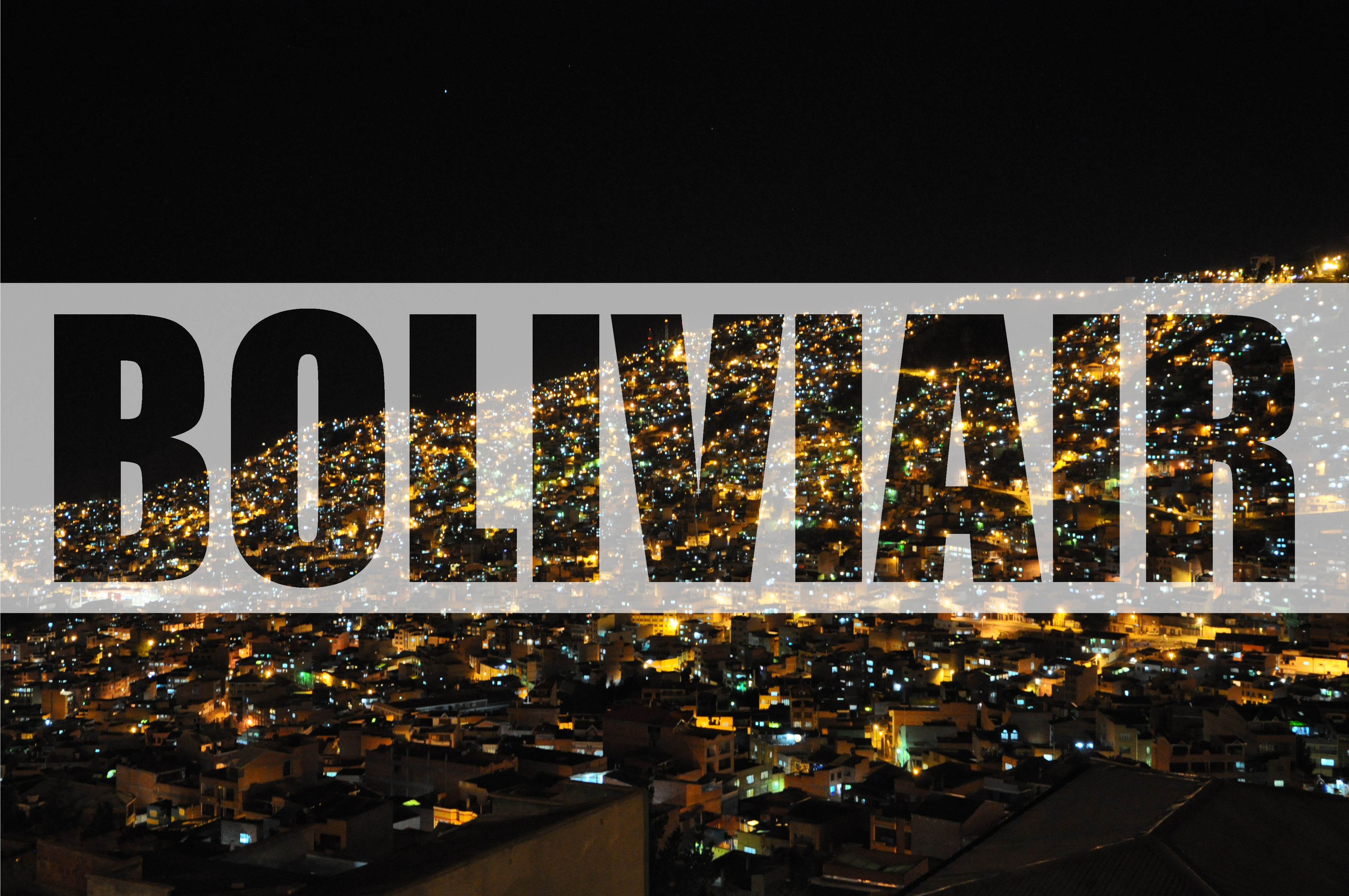
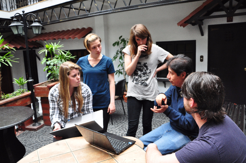
We are BoliviAir, a group of four undergraduate and one graduate student that have traveled to South America to study air quality in the cities of La Paz and El Alto, Bolivia. Our team consists of Jeremy Nichols, a civil engineer, Heidi Vreeland, a grad student, and Emily Flood, Francesca Metcalf, and Chelsea Dyess, all undergrad environmental engineering students. Our goal is to determine the current conditions of commuter pollution exposure on the various available forms of public transportation. La Paz is unique in that they have recently installed a cable car mass transit system termed the Teleférico. We will be comparing the personal exposure of many different types of air pollutants between the cable car and conventional forms of ground transportation.
March 20, 2015.
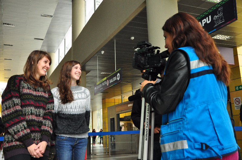
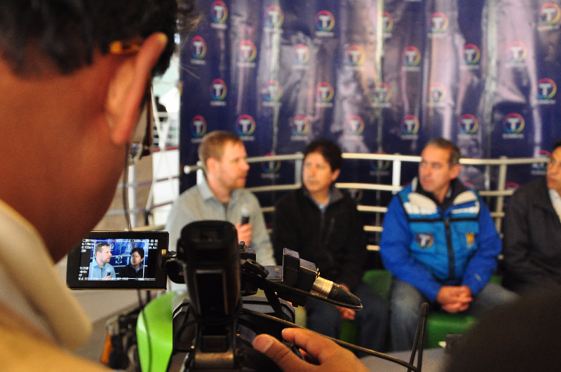
Quite the excitement with today’s air adventures! Our team was invited to be interviewed by Bolivision, a news and television station that serves Bolivia. Dr. Brown answered questions in front of a panel while Heidi and Francesca were asked to give some statements about our work on the cable car and their overall thoughts on the Teleférico project. You can read an article with a recap of the interview here.
Later in the evening, we took our final measurements while riding the new diesel buses that serve the city. With that data, we will be able to make comparisons between all of the common types of mass transit in the city: cable car, taxi, micro bus, and full size diesel bus.
Tomorrow we will be exploring the yungas, a lower altitude and higher humidity region of the country that serves as a buffer between the arid Alto Plano and the tropics closer to the Amazon basin. This jungle region is known for its beautiful waterfalls and monkeys. It should be yet another adventure for the air team!
March 19, 2015.
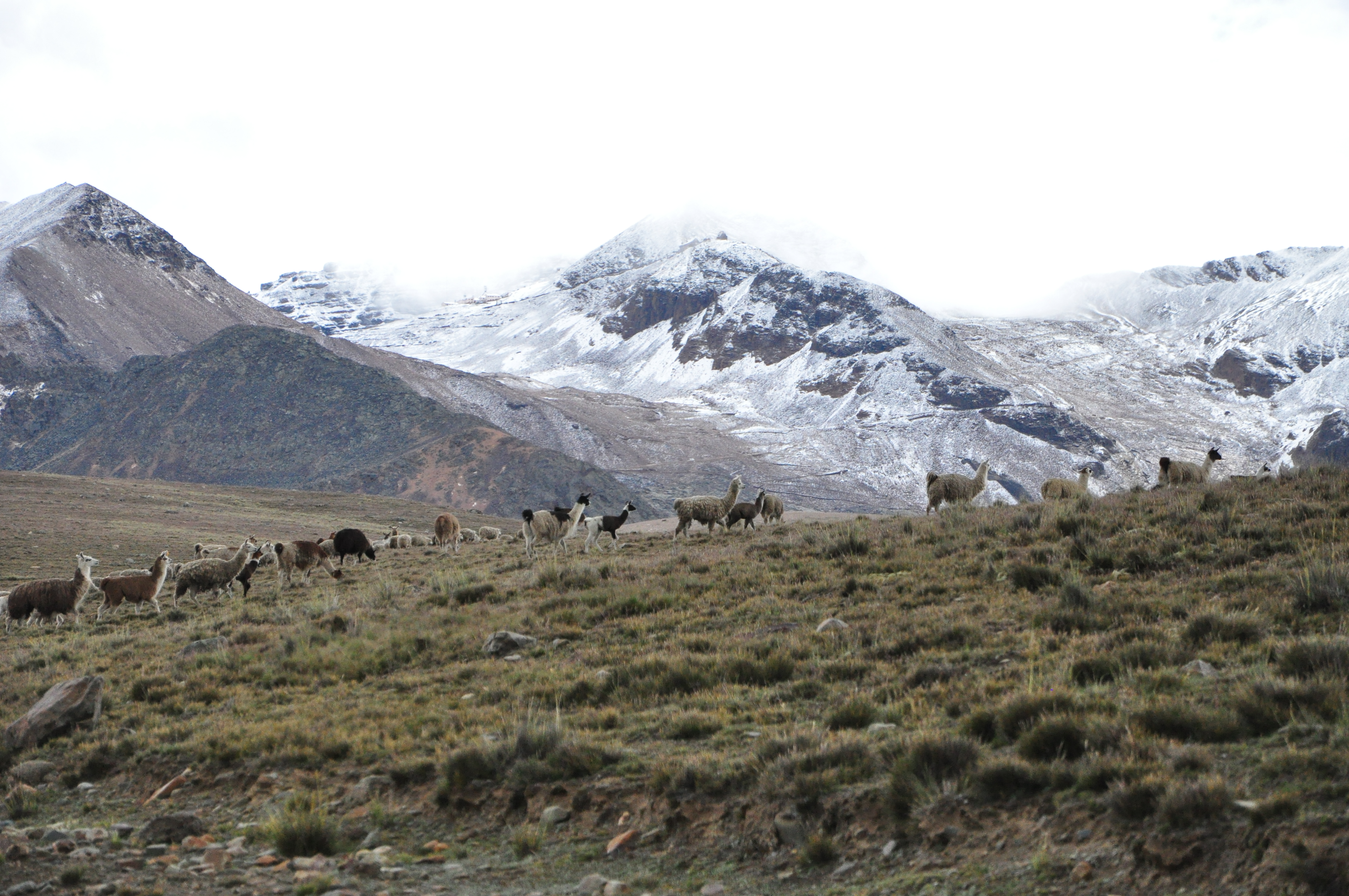
Today was quite the adventure! We arose and joined Marcos and Isabel for a day trip to Chacaltaya, an air quality monitoring lab located on a ridge in the nearby Andes Mountains. The trip took approximately two and a half hours and was accompanied by an elevation rise of nearly 1000 meters. Along the way, we saw many beautiful views of the snow-capped Andes as well as a large herd of llamas.
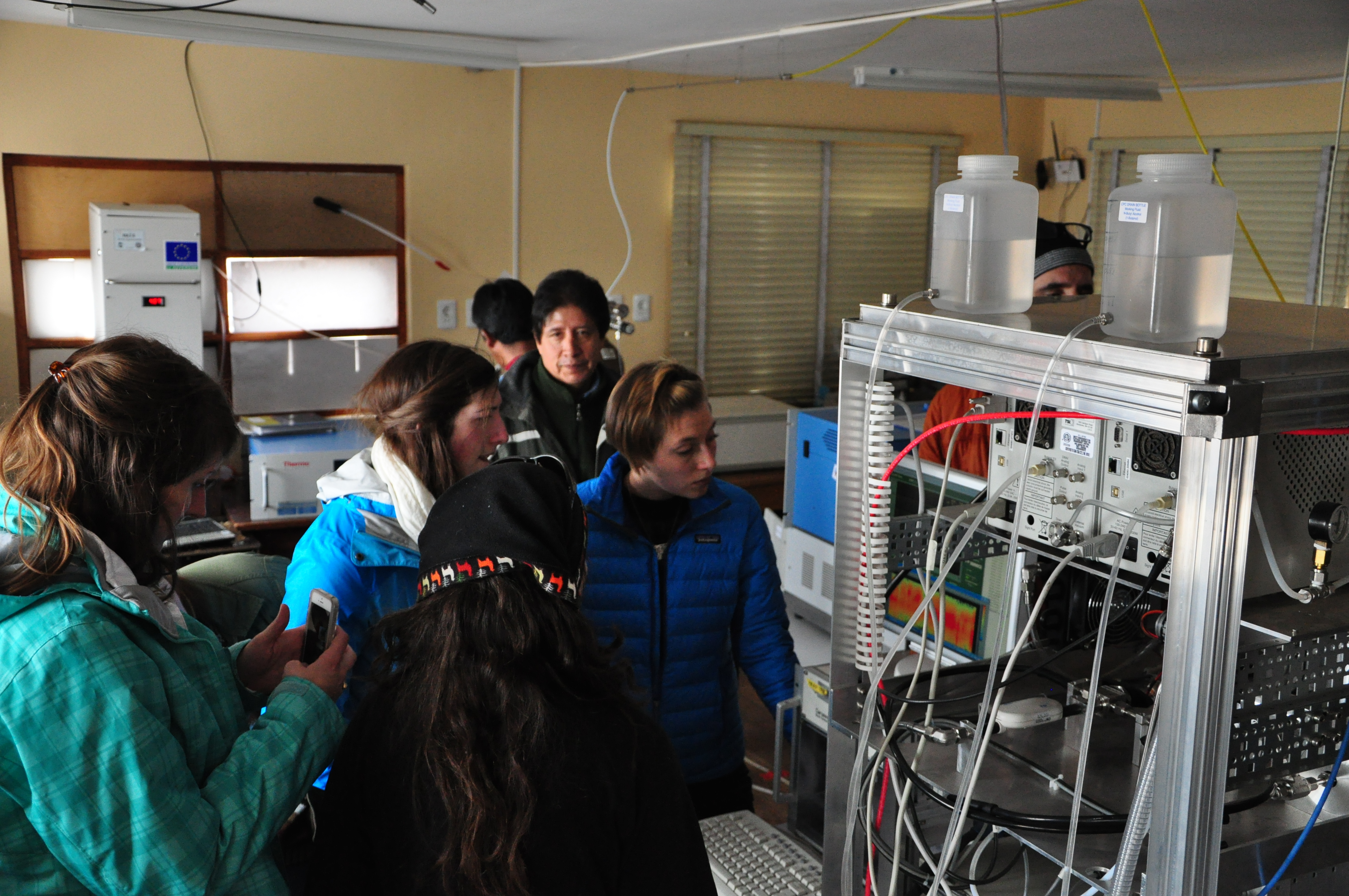
Once we reached Chacaltaya, we got the chance to explore the lab's surroundings. Though the building was older, the instruments inside were quite advanced. While learning about the many air quality parameters monitored there, we had the opportunity to set up our hand-held instruments and perform a side-by-side comparison with their more sophisticated lab counterparts.
While waiting on the comparison data, we hiked through the wintery mix to the summit of the neighboring mountain, which was once home to one of the highest ski slopes in the world. Although the glacier disappeared in the early 2000s, the valley remained in the shadow of the ridge. We lost sight of both the car and the summit early on as a result of the low visibility, and we felt the strong effects of the altitude as we made our way up the crumbling slope. We finally reached the top, where we all felt a bit euphoric from having reached our goal (as well as from the lack of oxygen).
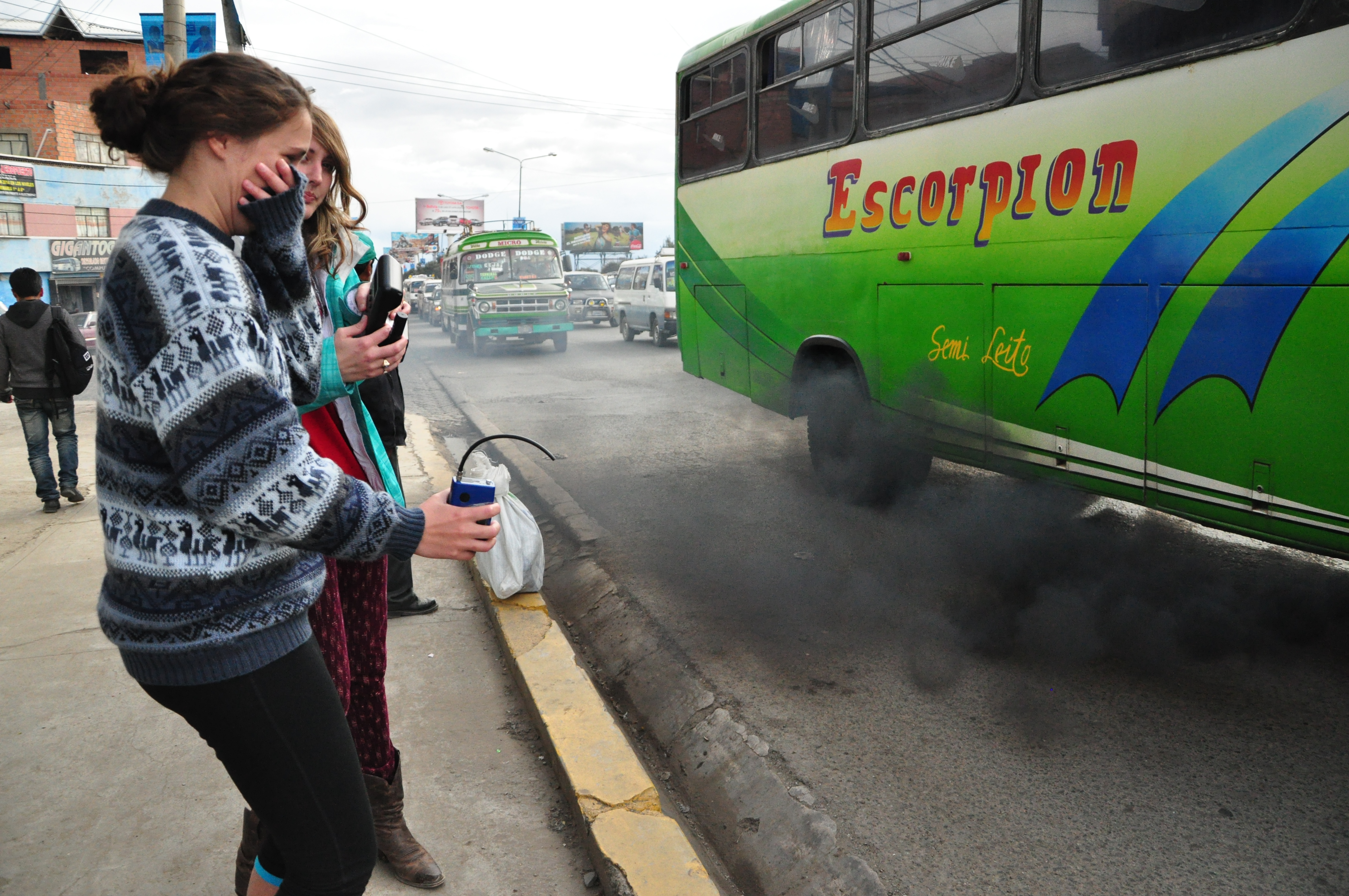
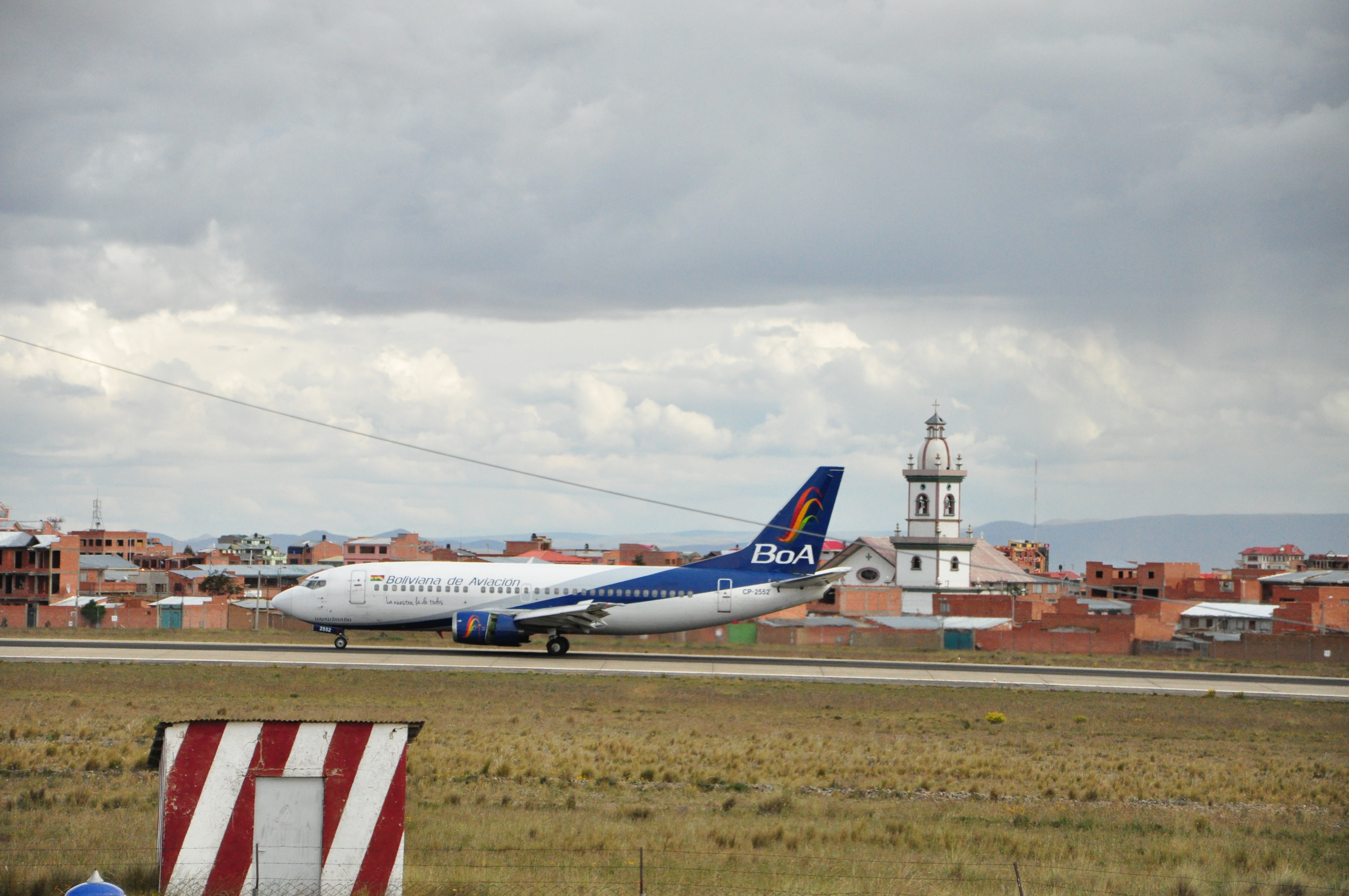
We descended from Chacaltaya and headed to the airport to take some more measurements. The goal of this experiment was to determine how quickly the pollution from point-source emissions (vehicles, in this instance) mixes with the relatively “clean” background air at the airfield. While the air quality at the airstrip was relatively good, the roadside was abysmal. Many of the vehicles that traverse the main thoroughfare have little to no emissions control and have emissions that would be well above regulations in the United States.
The evening was spent recuperating from the extreme pollution exposure that was endured. The group found an authentic kebab restaurant, where we enjoyed a well-deserved reprieve from the day's trials. Tomorrow morning, we will be interviewed by a local news station to talk about the work we've been doing with transportation analysis.
March 18, 2015.
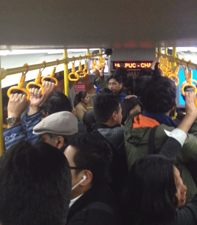
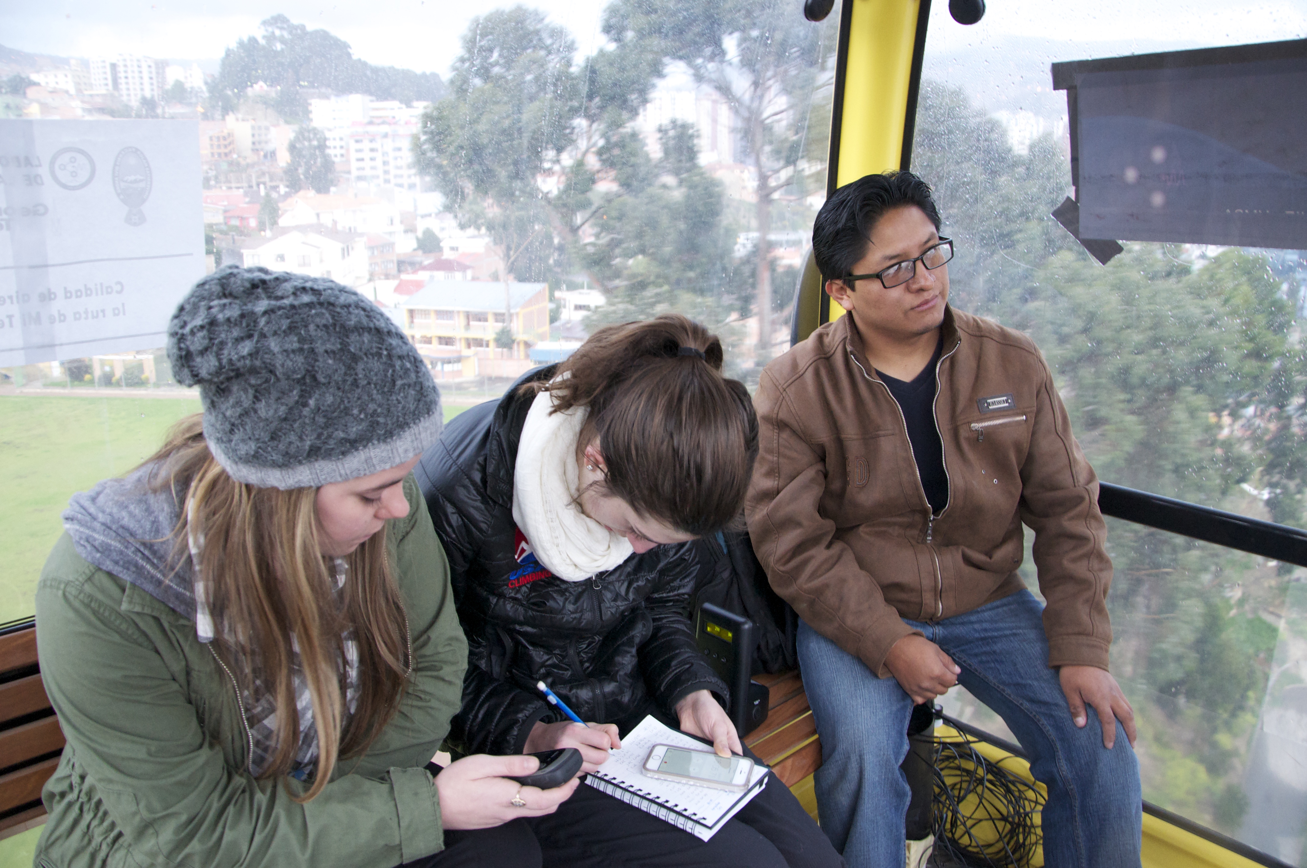
This morning we split into two groups to obtain data from pedestrian trafficked areas both on foot and in the ever present micro buses. One group traveled to the final yellow line Teleférico station (Qhana Pata, also known as Satalite) via car to retrieve the memory cards from the AQSD. Meanwhile, the other group used a combination of public transport (micro bus) and walking to travel to the downtown commercial district of La Paz. The data collected in the morning represents the route many locals take to commute from El Alto to La Paz. We expect this will be an appropriate comparison to the measurements taken on the Teleférico route that covers the same ground.
Some of the most intriguing data comes from our carbon monoxide detector; our initial hypothesis that the cable car exposes commuters to substantially less pollution than ground transportation was preliminarily confirmed.
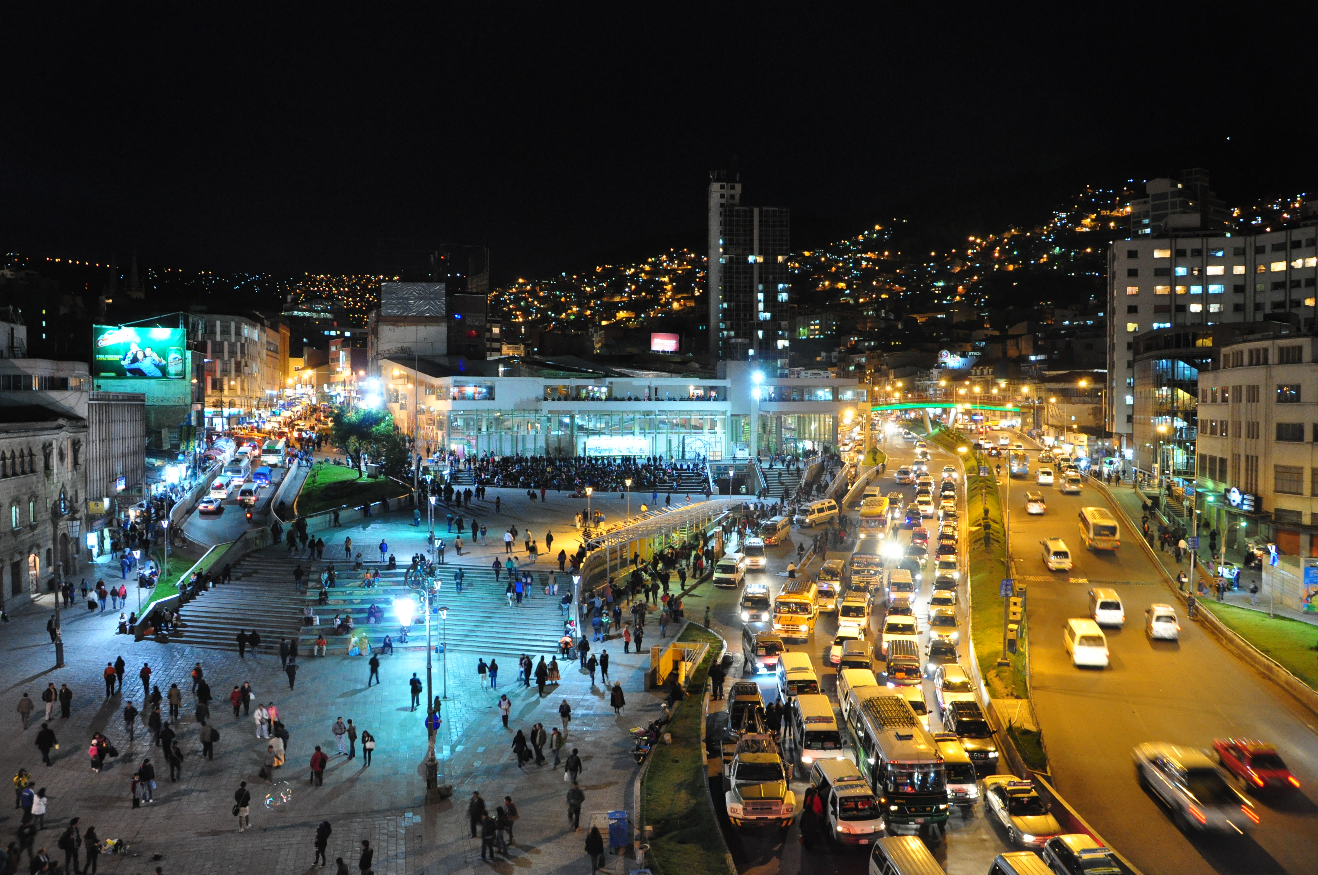
Downtown La Paz curates a wealth of culture in the vicinity surrounding the historic iglesia San Fransisco. We happened upon a political protest march before sitting down to a traditional four course Bolivian lunch. After eating our fill, we wandered the intertwining back streets and filled our satchels with purchases of sweaters, silver, and souvenirs.
Come evening, we repeated the pedestrian exposure tests while venturing further into the maze of cobblestone side streets. Dinner was enjoyed from a rooftop cafe overlooking the square in front of San Francisco, complete with views of the surrounding sky scrapers and mountains.
On the way back to the hotel, the group piled into a taxi where we were able to collect another round of commuter exposure data during the tail end of rush hour. Tomorrow we are going to Chacaltaya to explore Marcos' lab 15000 ft. above sea level!
March 17, 2015.
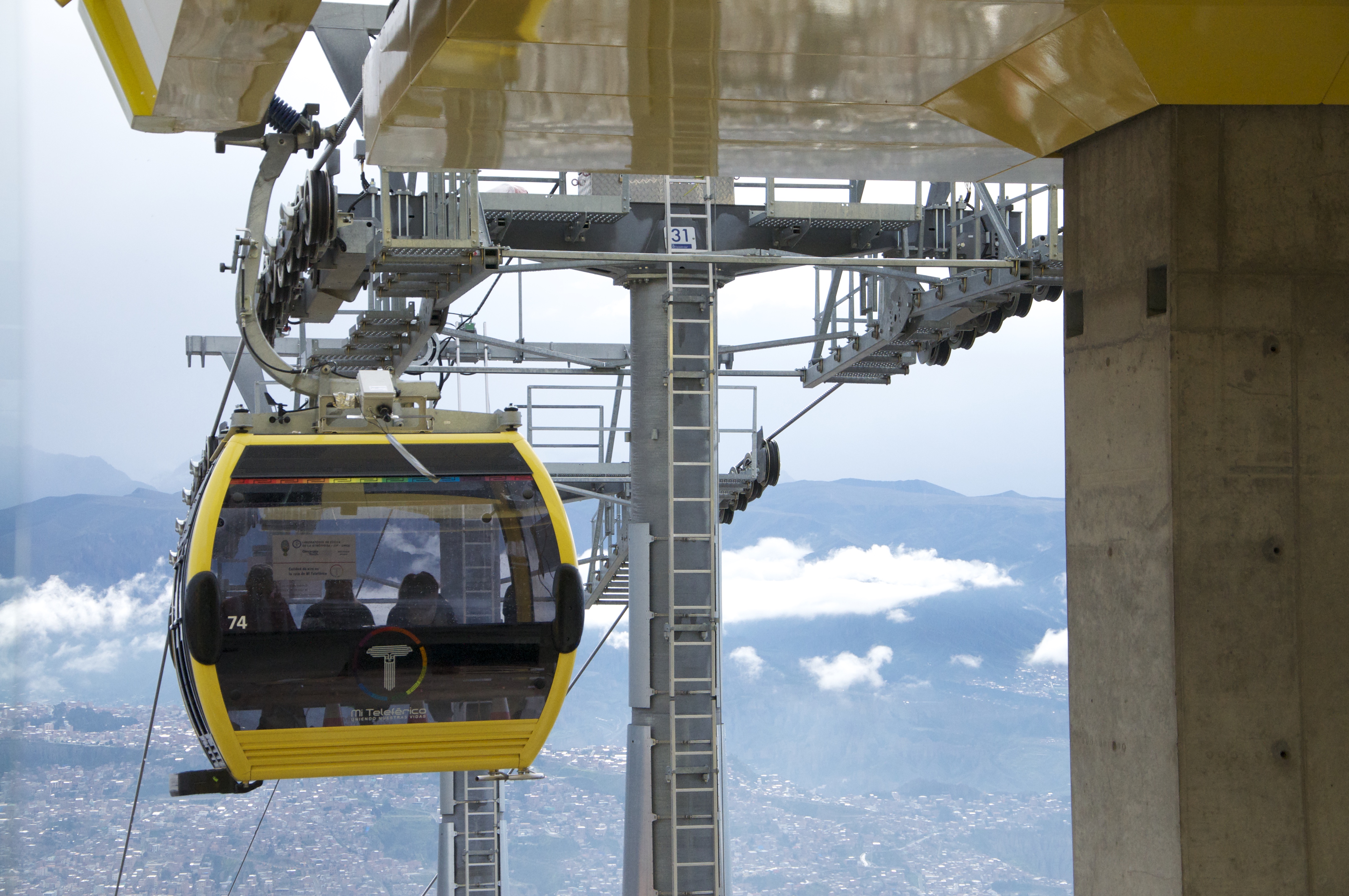
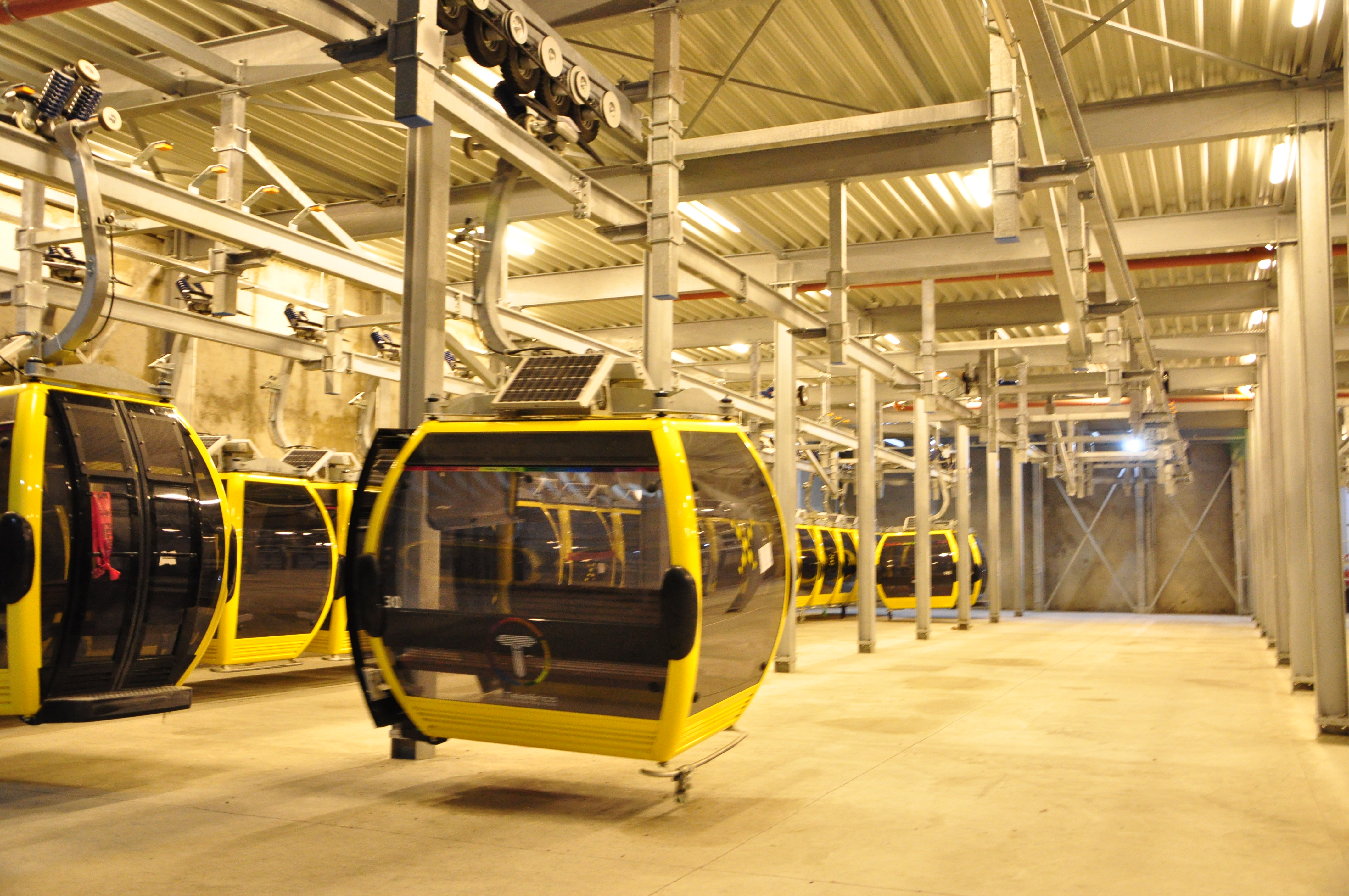
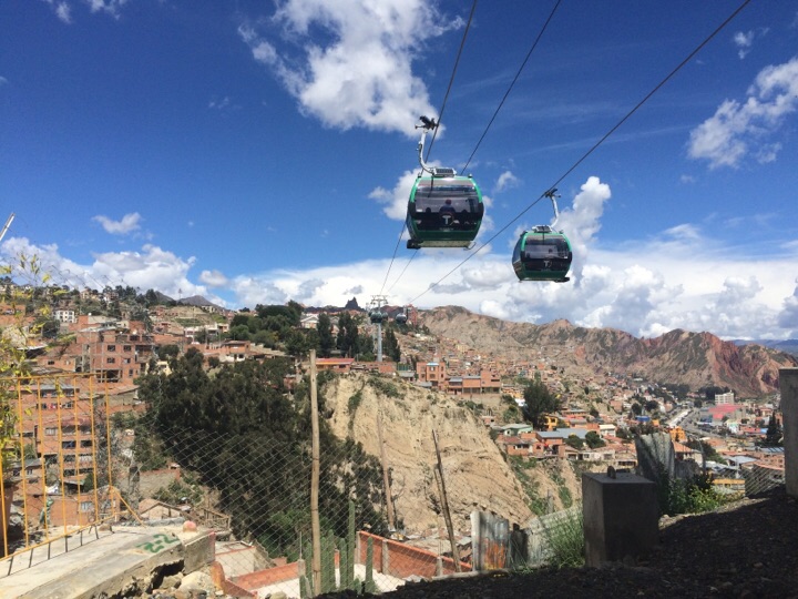
Today, we awoke at 4:30 AM to travel to the Teleférico and officially begin our research! We met our hosts at Libertador, the Teleférico station where the green and yellow lines meet. The Teleférico is comprised of three lines in total: red, yellow and green. Our focus today was on the yellow line, which runs between La Paz and the outlying city of El Alto. Since many Bolivians living in El Alto travel to La Paz daily for work, this route is of the utmost interest to us due to its heavy commuter use. It is also the steepest of the three Teleférico lines, which we believe will lead to a wide and interesting range of data.
We were allowed special access to a reserved cable car thanks to a partnership between Mi Teleférico and Universidad Mayor de San Andres. This was the same cable car on which the AQSD was mounted the evening before. In the cable car, we brought with us other handheld air quality equipment and a GPS in order to determine our position and altitude. We also had two of our group members stay at the last, and highest, Teleférico stop- Satelite- to provide us with stationary background data. We then repeated the same process during the evening rush hour to see how the two times compared and had a static station at Libertador. Between the two collection periods, we met with Marcos to look over preliminary data from the morning.
Our first mission to collect data was a complete success! We are so excited to now analyze the data we have so far to see how altitude affects personal exposure on the Teleférico!
March 16, 2015.
Today we began doing research for our transportation analysis. Our purpose is to measure the amount of emissions that come from different forms of transportation in La Paz. Our primary focus is on gathering data on the Teleférico and comparing this to the levels of personal pollution exposure from the microbuses and cars that are prevalent throughout the city.
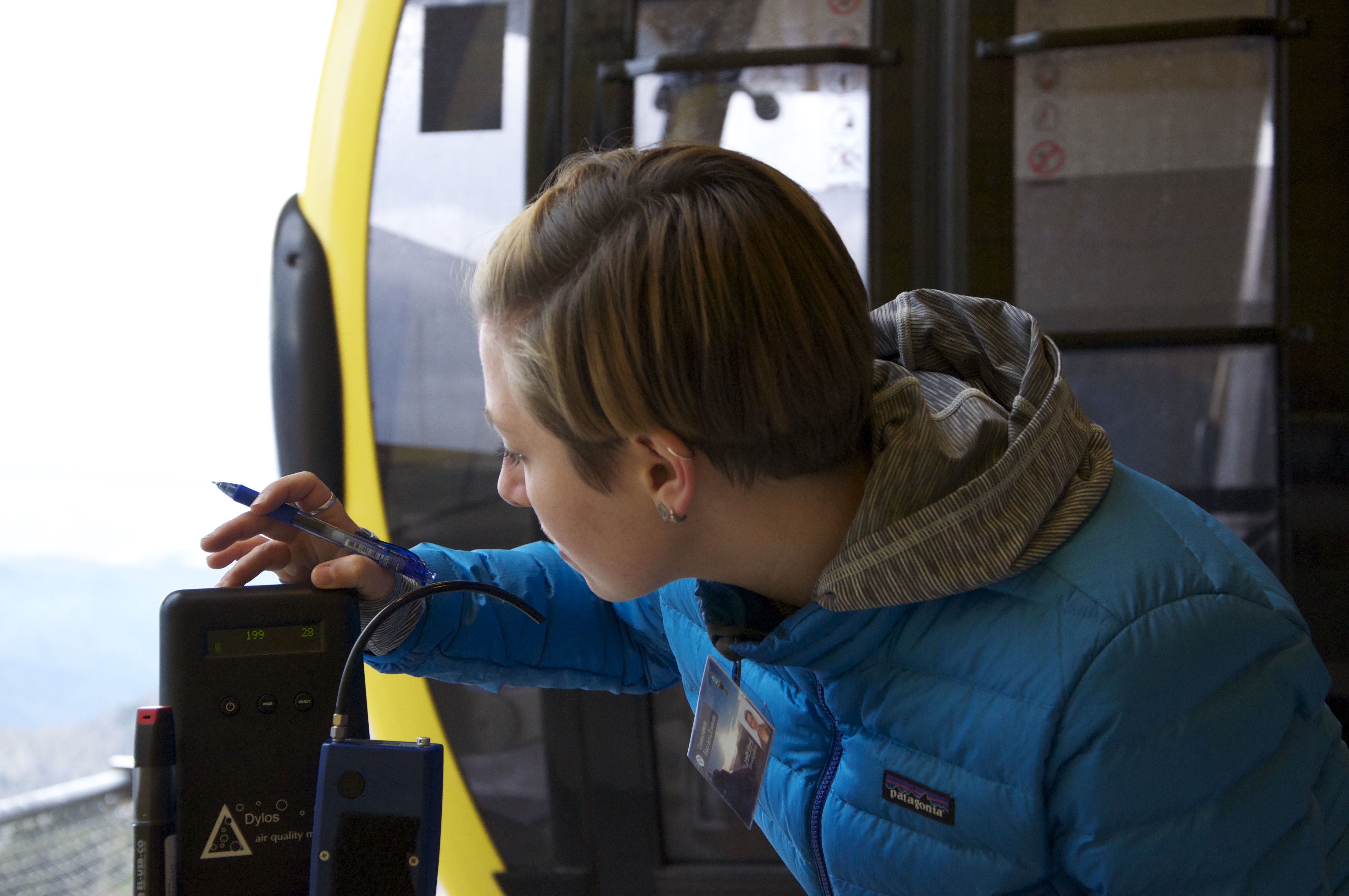
The equipment used includes a Dylos particulate matter counter, a MicroAeth black carbon counter, a USB carbon monoxide monitor, and a specially crafted Air Quality Sensing Device (AQSD) that includes CO, NOx, CO2, particulate matter as well as meteorological data including temperature and relative humidity. This wide variety of instrumentation allows us to capture a holistic image of the current state of pollution and commuter exposure in the city.
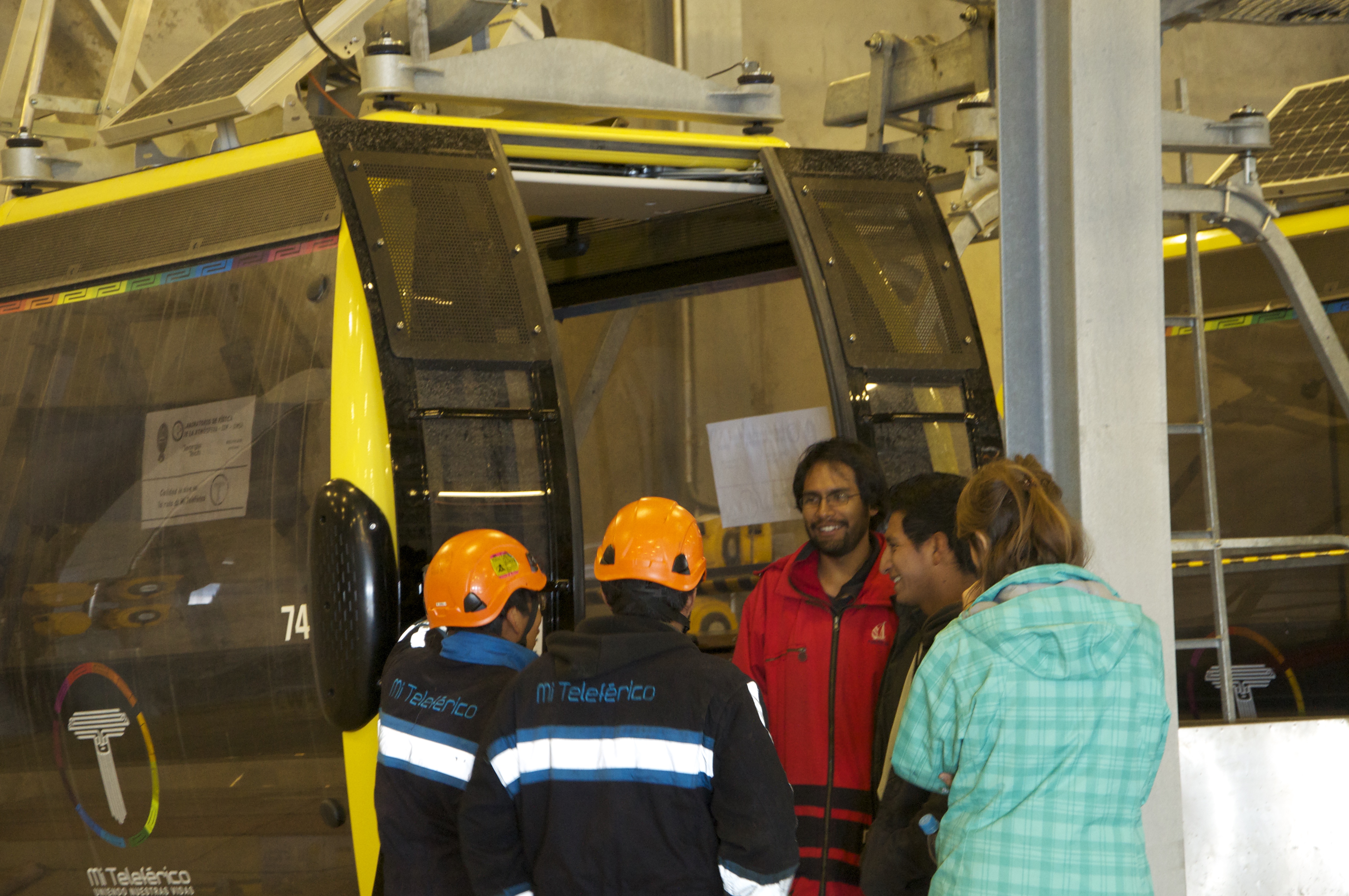
In the morning we visited the Universidad Mayor de San Andres, where we were hosted by Dr. Marcos Andrade and Dr. Isabel Moreno of the Laboratorio de Fisica de la Atmosfera. We, along with our advisor Mike Bergin, introduced our hosts and their students to the equipment brought. To ensure quality data a number of tests were ran on the instruments including checking the power supplies for the devices, and double checking that the air flow wasn’t altered due to the change in altitude. Most importantly, we ensured that overheating wouldn’t be an issue with the AQSD when placed in intense sunlight and running off of a 12 volt car battery.
After fixing the power problem, the AQSD was mounted on top of the Teleférico with help from the students and faculty from the university. Tomorrow we will finally gather data on the Teleférico and begin our research!
March 15, 2015.
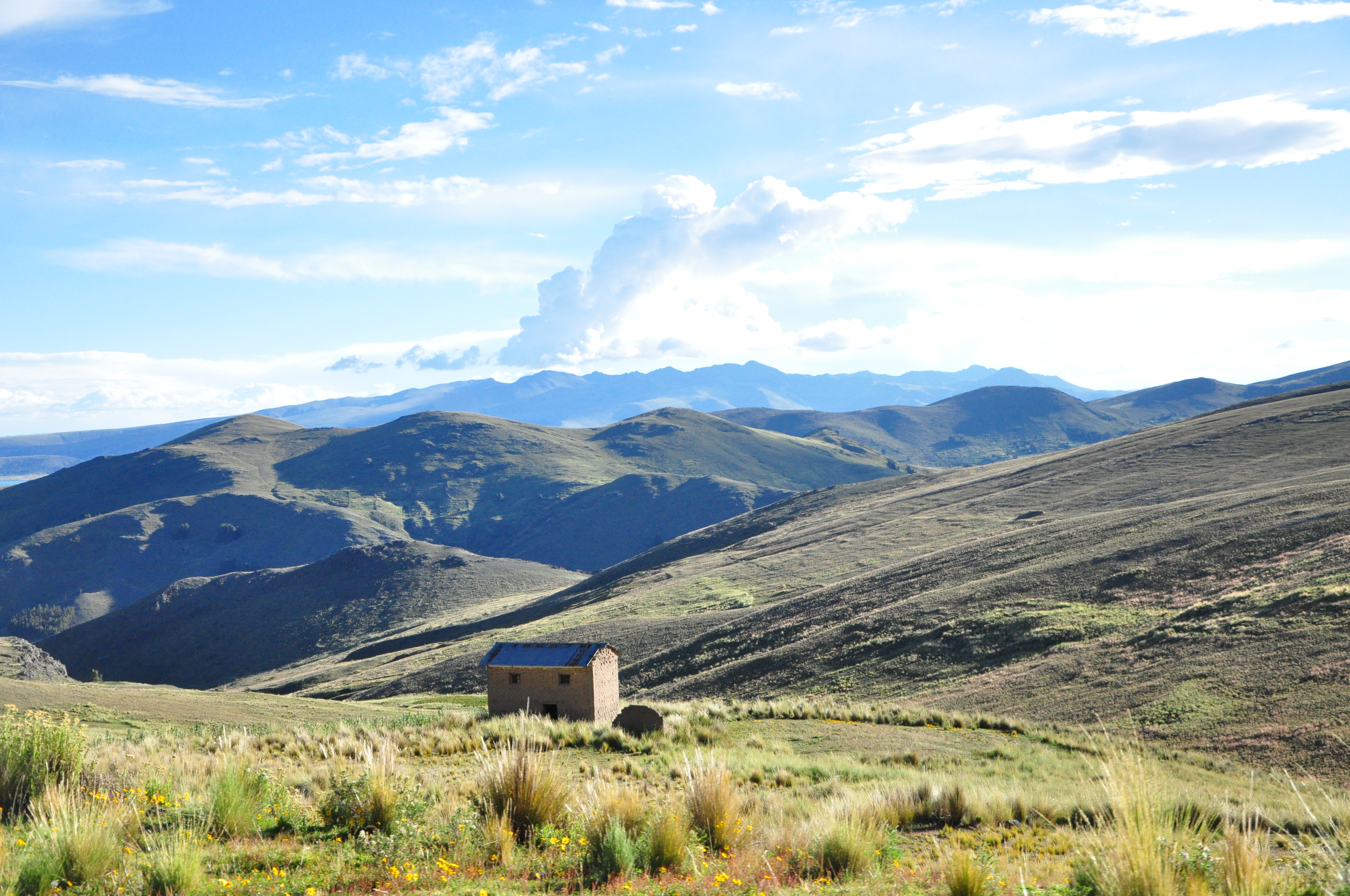
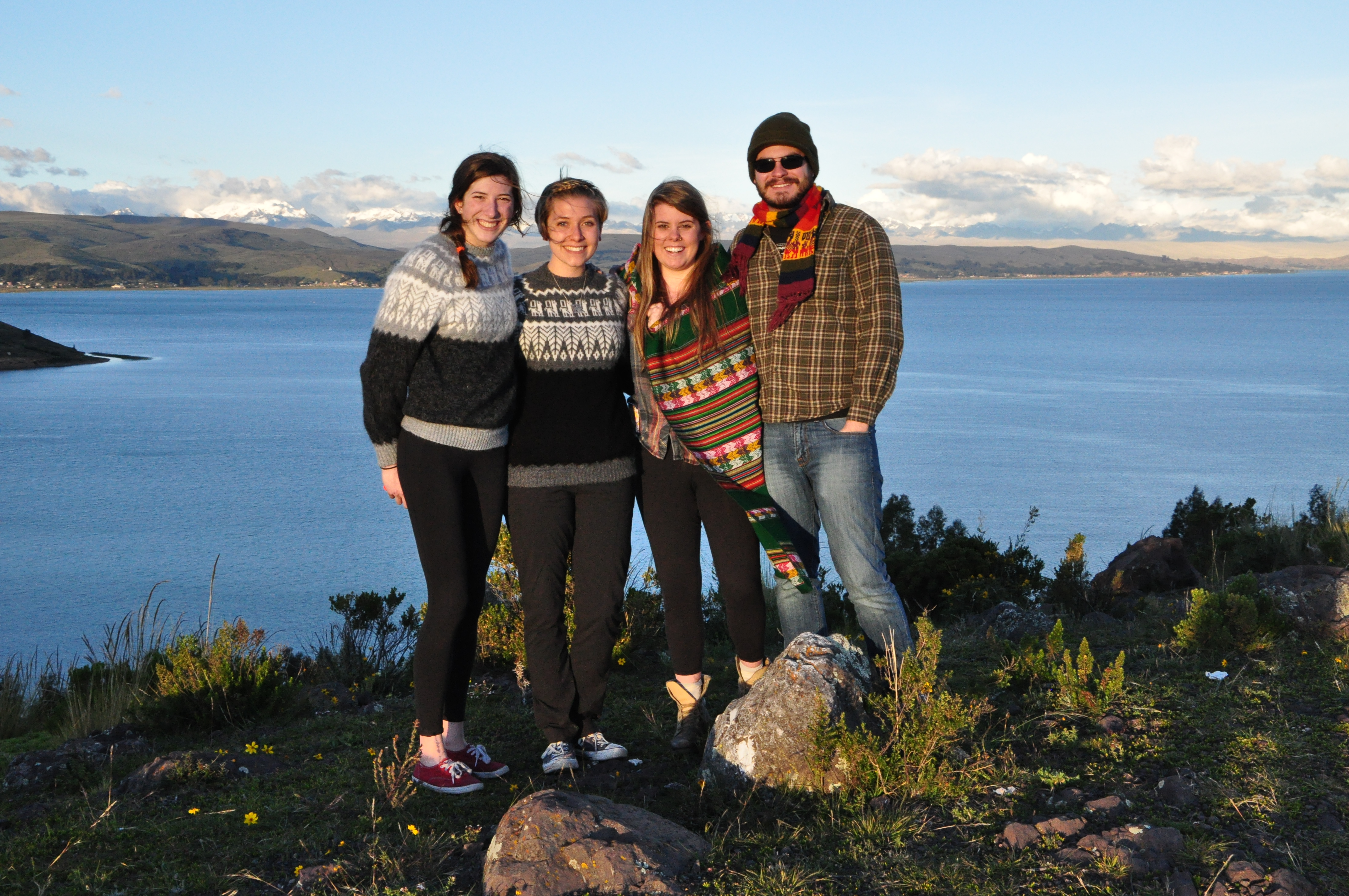
Our second day in Bolivia was spent exploring the countryside on our way to Lake Titicaca. During our trip, we were able to get a glimpse into the everyday life of the citizens of the country, especially the most common forms of transportation between La Paz and El Alto, and the surrounding cities.
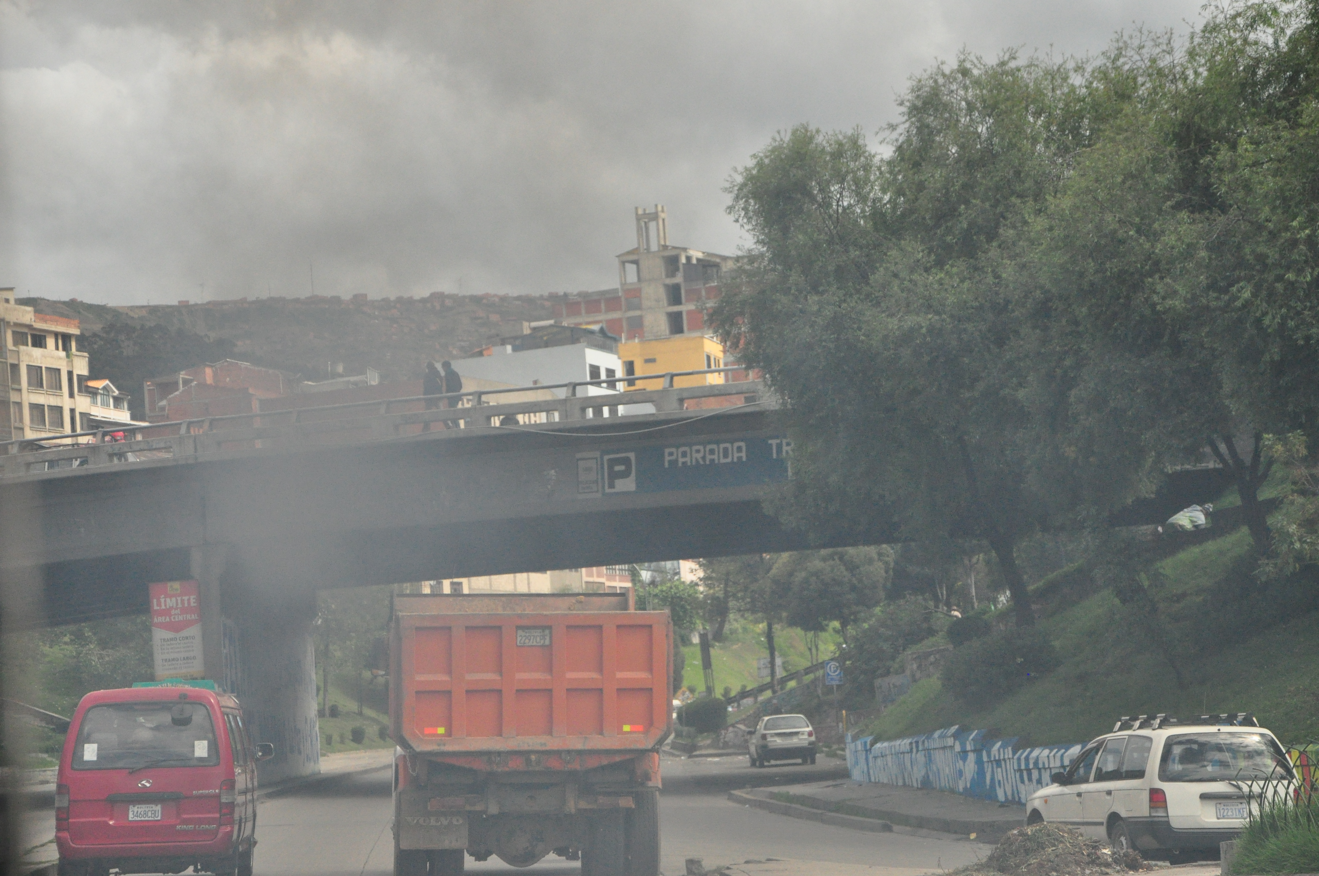
Most prevalent of all ground vehicles was the local 'Micro,' an economical alternative to a taxi or a city bus. The worst visible emissions were from large diesel shuttle busses, which belched black smoke as they traversed the hilly terrain. It was interesting to finally lay eyes on the traffic and emissions that we have been preparing so long to analyze.
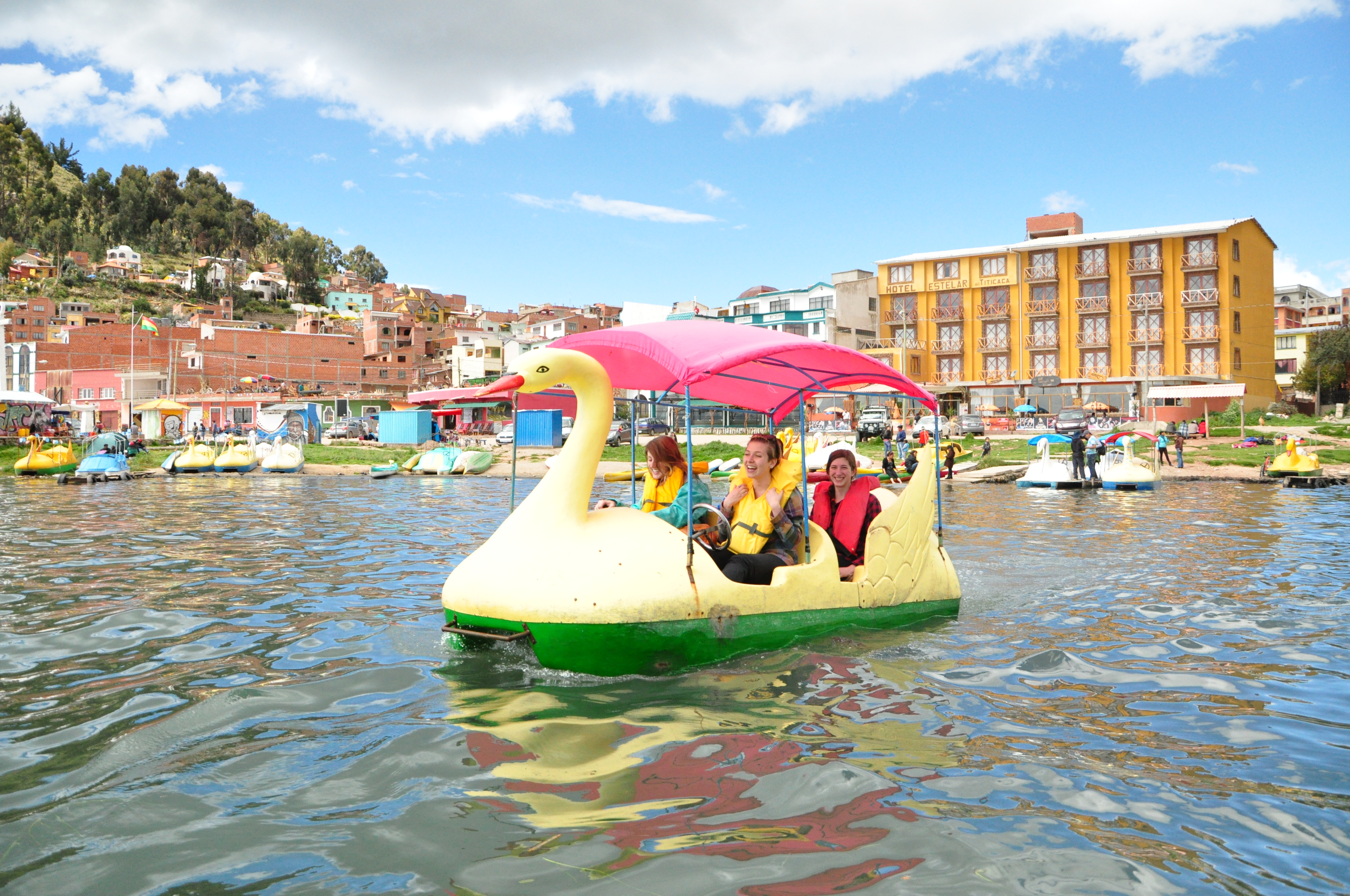
Our final destination was Copacabana, a small tourist friendly village on the banks of the lake. While there, we were able to take in some local cuisine and do some shopping at the stalls that lined the street. The highlight of our stay in the city was a brief foray out onto the water in the iconic swan paddle boats.
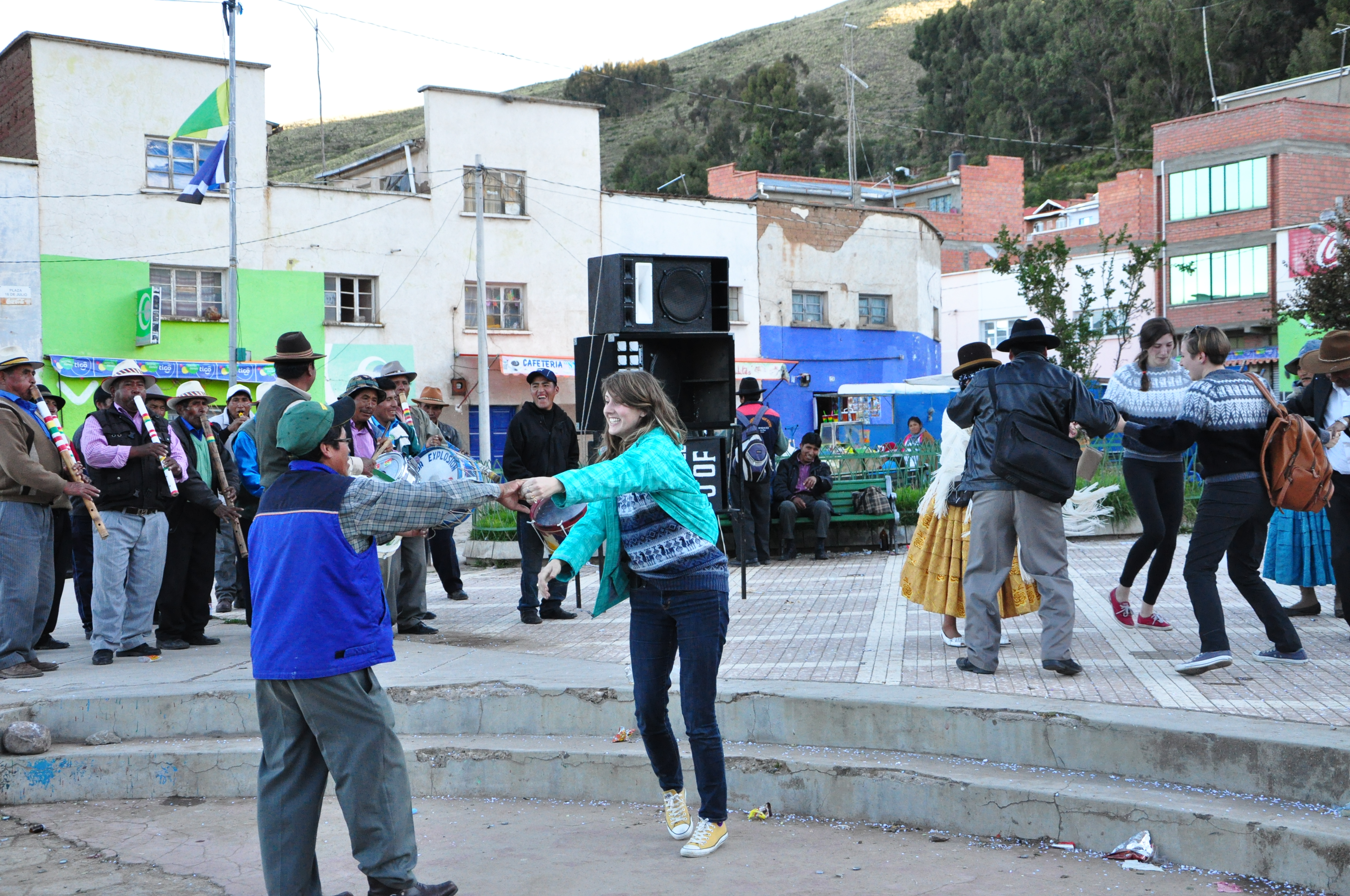
On the trip back to La Paz and our hotel, we witnessed the end of a wedding ceremony, and a few of our members even got the chance to participate in the dancing. We were also lucky enough to witness a rainbow over the Andes that backdropped the shining waters of the lake. It was certainly a great way to end the day!
March 14, 2015.
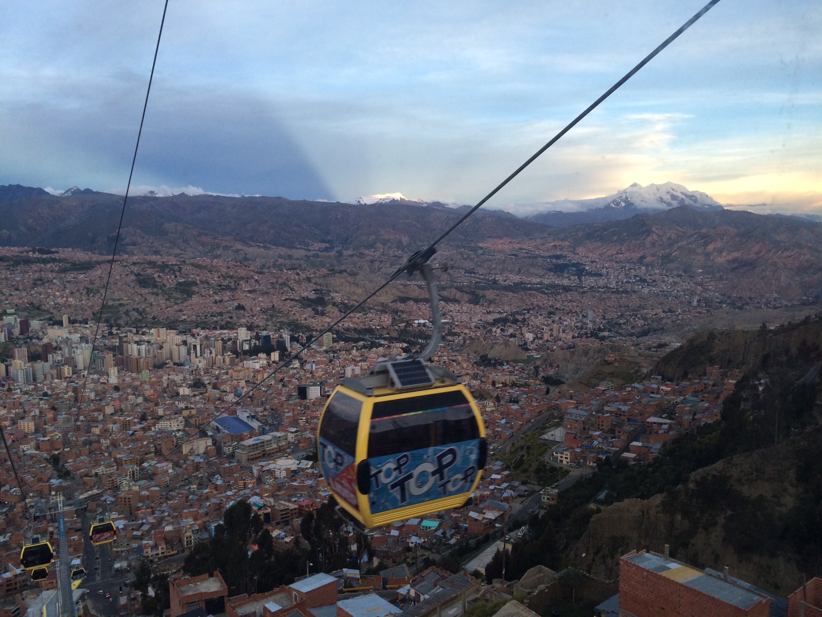
Wow we finally made it to La Paz. After months of preparation our research has finally begun and we couldn't be more excited. Today we took a ride on the Teleférico to get a feel for the environment we will be in for the upcoming week. Check out how pretty La Paz looks from up above!
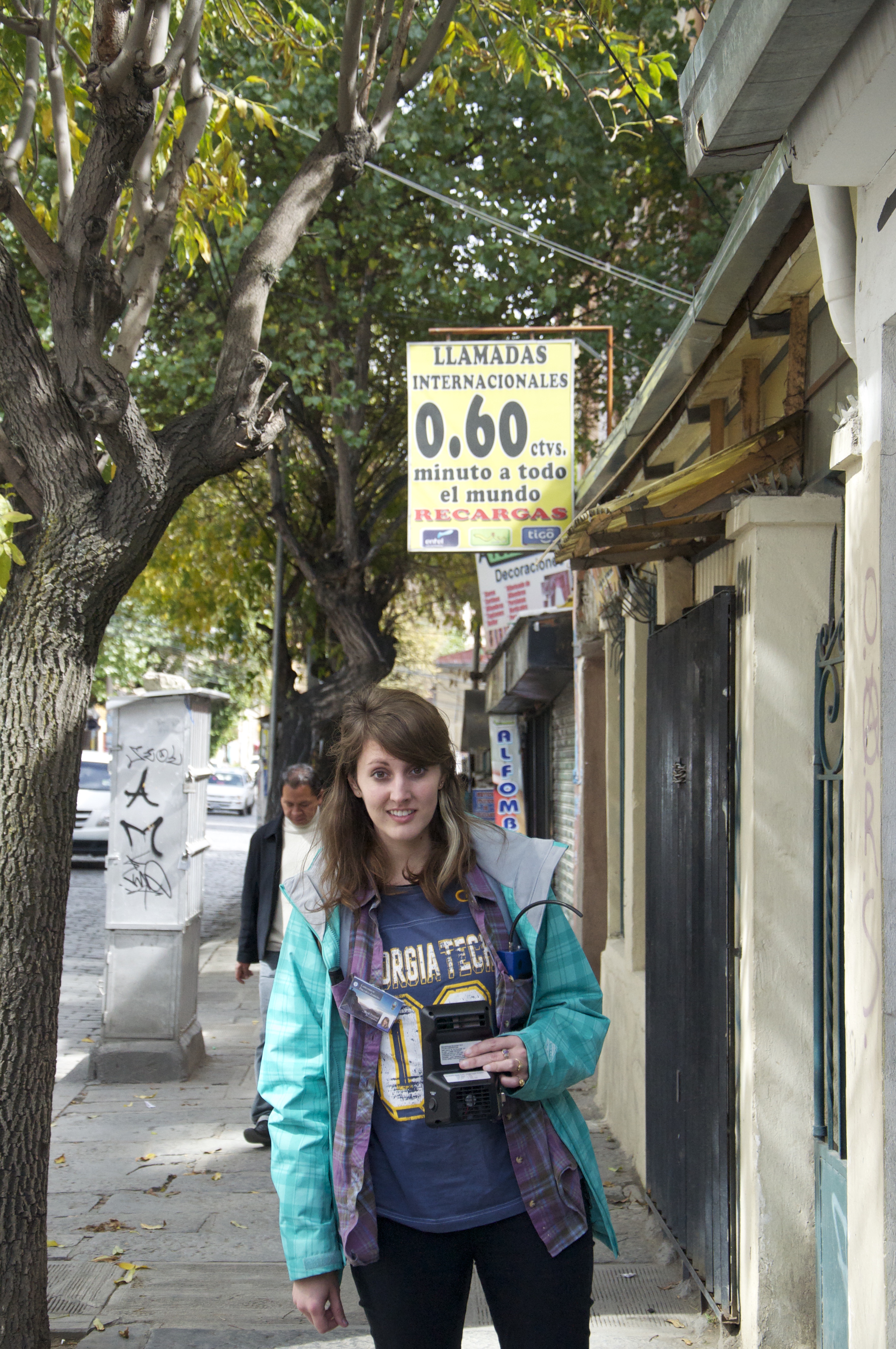
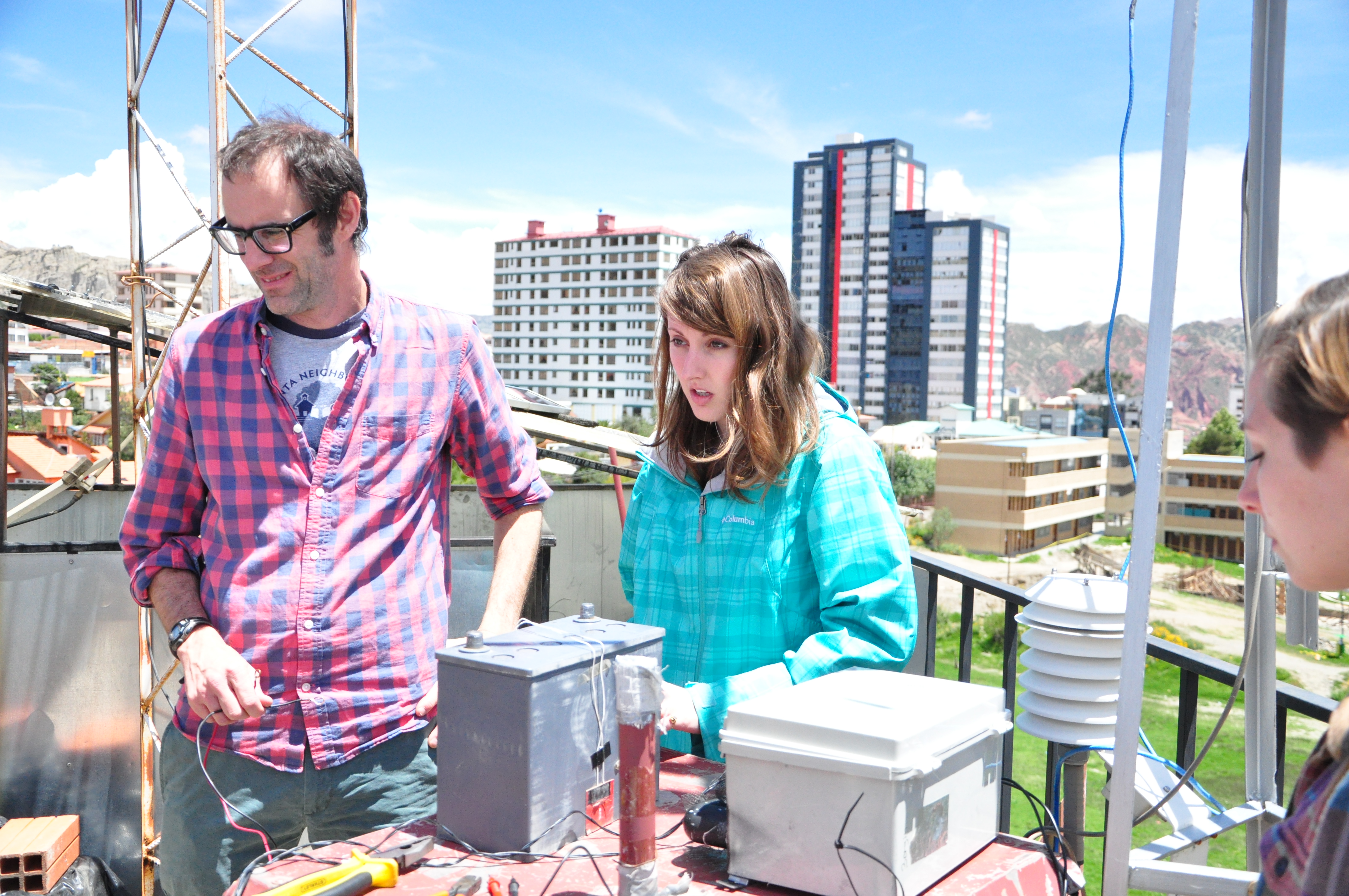
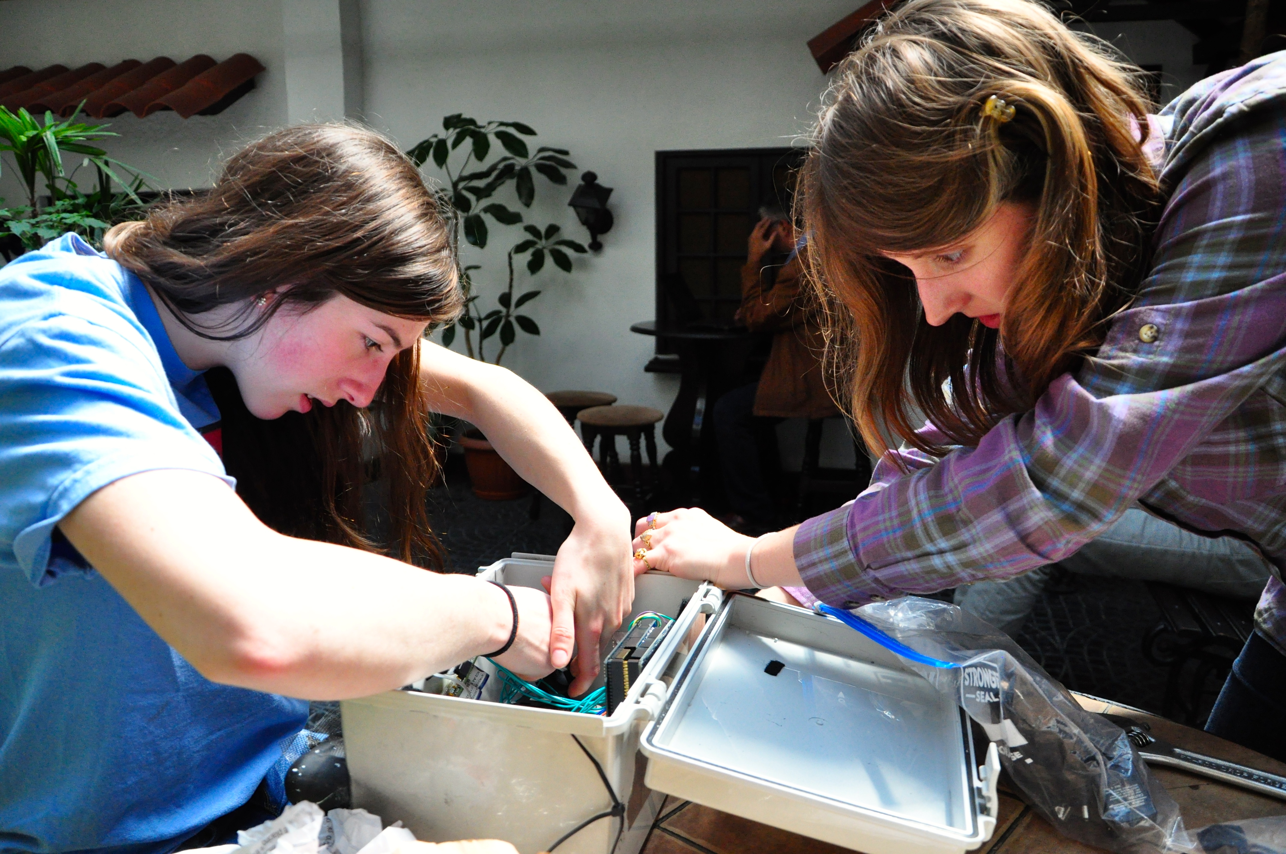
Unfortunately upon our arrival, we discovered that one of the most essential pieces of equipment had been damaged in transport. Luckily, our team members came prepared and we were able to repair the device in short order. To the left, you can see Heidi and Francesca working to get the Air Quality Sensing Device back up and running.
Regardless of this minor set back, we are so excited to experience everything Bolivia has to offer. We can't wait to meet the people, see the country, and make a positive impact on the landscape!